GNOME - General NOAA Oil Modeling Environment
The model is freely available for download from NOAA at http://response.restoration.noaa.gov/software/gnome/gnome.html and can quickly run on a pc. Download and install GNOME and the location files for five locations: Casco Bay, Maine; Mobile Bay, Alabama; Narragansett Bay, Rhode Island; San Diego Bay, California; and the Persian / Arabian Gulf. After completing these exercises, if your command has GNOME version 1.1.4 available, download the SWAFS currents file from NAVO for the Arabian Gulf and try running GNOME using those as forcing.
In this tutorial, we will step together through an example of setting up and running GNOME in the standard mode.
1. Start up GNOME
2. Select the Location:
You will immediately be led through some questions, first about the license (click "ok") and then to select a location file. NOAA has created location files for many regions, and these contain the topography, climatology and tide data for that location. Click Select file when asked, and choose ROPME.loc in the file browser window. ROPME is the Persian Gulf region; the acronymn stands for Regional Organisation for the Protection of the Marine Environment.
|
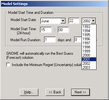
3. Set up the Model run parameters:
For the model start date, choose June 22, 2001.
Then hit the Next>> button. |
 |
|
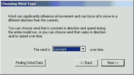
4. Set up the winds:
Choose the default, which is constant over time. |
|
|
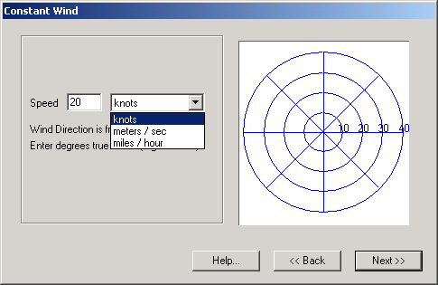
Enter a speed of 20 knots and a wind direction from the southeast. |
|
|
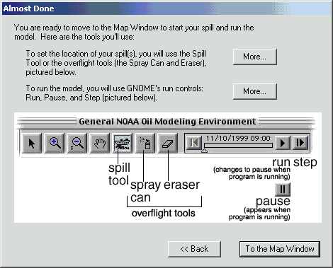
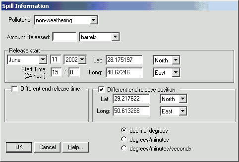
5. Spill some oil:
Once you view the instructions (as in the screen shot on the right) and then click To the map window, the map of the Gulf appears. You will see an icon highlighted above the map that represents a ship spilling oil. Click that icon. Nothing appears to happen, but you will see a small cross-hair cursor. Place the cursor over a location to spill the oil, and drag it across the Gulf to get a cross-section. Then release the cursor. |
|
|
You should see a window similar to the one on the right asking about the type of oil and the amount released. Choose non-weathering and 100 for the number of barrels. For release start, change the date to June 22, 2001. Click OK. |
|
|
6. Run the model:
You can either click Model and then select Run from the menu, or click the Play control directly above the map. You should see the oil splots begin to move to the northwest. Change some parameter(s) and re-run the model. Experiment with increasing the windspeed or direction, or add another oil spill. |
|
Now you know the basics of how to set up a model run in GNOME. Next you will use GNOME to explore how tides and winds affect the oil's trajectory. Continue to the GNOME Homework Exercise now.
Last Update: 26 March 2003
The NOM Group
Disclaimers