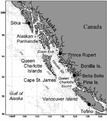
Figure 1. Location map of the west coast of Canada and southwest Alaska. Depth contours are in meters.
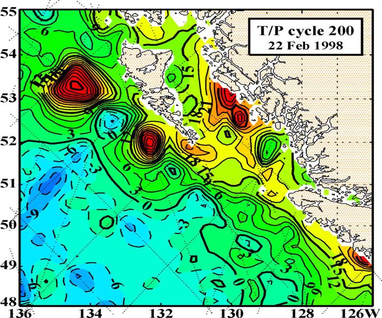
Figure 2. Contour plot of sea level anomalies based on altimetry data from TOPEX/Poseidon and ERS-2 satellites.
OC4331-Mesoscale
Oceanography
Final Project Summary
Topic Area
LCDR Todd Derley, USN
Major Findings
The "Haida-1998" eddy was anamalous due to it's height and size, not its existence. Climatology shows that on adverage there are 1.3 Haida eddies generated each year with heights up to 40cm. The sea surface height anomallies associated with these particular Haida eddies was over 50cm. Haida eddies form during the winter months in concert with the change of wind direction. The formation of these eddies,as discussed here, are also caused by the bathymetry,sea surface heights, temperatures and salinity content of the source waters located on the east side of Queen Charlotte Islands.
The Haida-1998 eddies formation cycle, origin, and where they propagated was all followed by satellites. TOPEX/ Poseidon and ERS-2 was able to monitor the height anomalies. AVHRR was able to follow the temperature anomalies. And SeaWiFS followed the chlorophyll anonmalies.
Figure 2. Contour plot of sea level anomalies based on altimetry data from TOPEX/Poseidon and ERS-2 satellites.
Crawford,W.R., Cherniawsky, J.Y., Foreman, M.G.G., and Gower, J.F.R. July 2002: "Formation of the Haida-1998 oceanic eddy." J. Geophys. Res., Vol. 107, 6-1 - 6-14.
Di Lorenzo, E., Foreman, M.G.G., and Crawford, W.R., Revision Jan. 2004: "Modeling the Generation of Haida Eddies." J. Deep Sea Reserch II
|
This is a government-maintained internet site. Please read the U.S. Navy web page disclaimer and the dislaimer regarding external links. |