


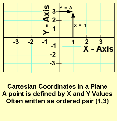
Another common
set of coordinates are the Cartesian coordinates. These are the axis
on standard graph paper and used in most function graphs. For example
the financial index's plotted against date seen in many weekend newspapers
are Cartesian graphs.
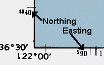
One example of Cartesian coordinates used for geographic positions is the Universal Transverse Mercator Projection. These list locations on topographic maps as "Easting" and "Northing" values. They are the funny sized numbers on the border with a large and small number together.
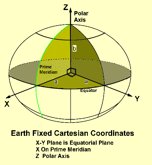
Another
example is the measurement of a location from the center of the
earth. Here three perpendicular axes with an origin at the earth's
center are used. The axis are called x,y and z. Z goes out the north
pole (spin axis of the earth), x goes out the equator where is crosses
the zero point of longitude, and y completes the set, going out
the equator at longitude 90 degrees East in the Indian Ocean. These
are often called Earth Centered, Earth Fixed (ECEF) coordinates.
There any many other types of coordinates, but these are the most common.
|
|
||||
|
|
|
|
|
|