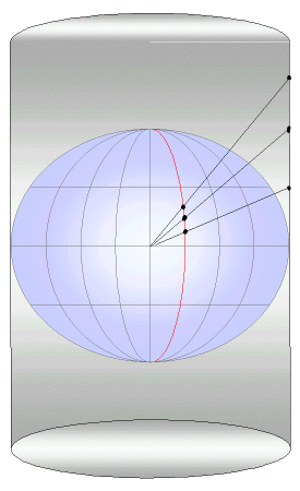


Round to Flat - Projections
The process of "flattening" the world to make a map is commonly done in a few dozen ways. This process is called projecting or using a projection. It came from the geometric interpretation of holding a piece of paper up near a globe and using a light to "project" an image on the paper. The paper may be rolled in a geometric form and the light might be inside or outside the globe.

The projections were done using straight edge, compass and string in the medieval or ancient days (projections from 200 BC have been found). Today mathematical formula are used in computers. There are some projections used today that have no good geometric intpretation, they exist just as equations.
There are a few general comments that apply to all projections:
|
|
||||
|
|
|
|
|
|