


Example of Datum / Datums
The Practical Definition
A“datum” is defined in various ways, mathematically, for the surveyor, and practically. It is the practical answer to the problem on determining accurate positions and making accurate maps. It can be thought of as a collection of surveyed points whose locations are accurately know with respect to each other.
A set of control points that might be used in the Monterey, CA area are shown below on a picture.
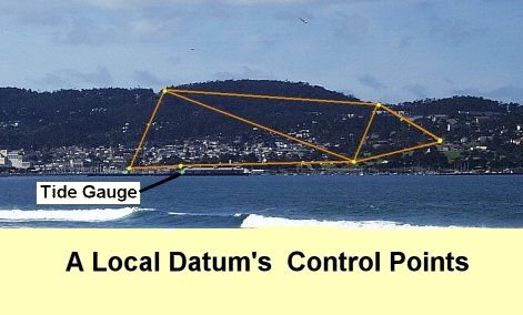
The tide gauge and it's ground reference mark are real. Notice that there is a point very near the tide gauge. This is common to tie the tide measurements to the land measurements. Here is one of the reference markers for this tide gauge.
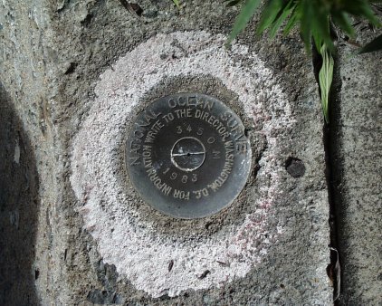
It is a bronze disk inserted into a bridge foundation. the name of the agency and the name/number of the "mark" are also given.
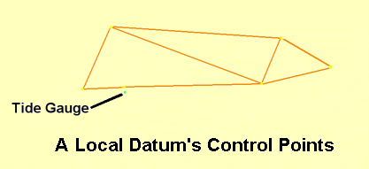
The above diagram without the picture shows the points. The lines connecting the points are the things actually measured in the survey.
The following diagram shows the same network without the background picture of Monterey.
Collections of control points like this are used to define the locations for mapping and are the user view of a datum. Geodesy books, however, usually begin with the modern mathematical definition and call this collection a realization of the datum.
Multiple Datums – Confusion and Error
However one collection, or datum, may not fit some other set (datum). It is in error with respect to the second collection of points. This occurs periodically as datums are updated with new information and survey techniques. It happens about twice a century in the US. In the last major datum change in the US, points typically “moved” by about 100 m (300 ft).
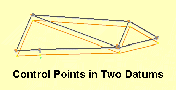
Mismatched datums are also commonly happen when two sets of control points are separated by large distances or over an ocean. Accurate use of a map depends on knowing the datum it is on. On modern topographic maps the datum is often given in the map legend.
|
|
||||
|
|
|
|
|
|