
Comprehensive Acoustic Simulation System/ Gaussian Ray Bundle (CASS/GRAB) MODEL
In
this week lab students will be running the Comprehensive Acoustic Simulation
System/ Gaussian Ray Bundle (CASS/GRAB) model to acoustically analyze the
MOODS, GDEM and MODAS datasets created in Lab 1. CASS/GRAB is an active and passive range dependent propagation,
reverberation, and signal excess acoustic model that has been accepted as a
Navy standard and will replace the CASTAR model. The GRAB model’s main function is to calculate eigenrays in
range-dependent environments in the frequency band 600 Hz to 100 kHz and to use
the eigenrays to calculate propagation loss.
The CASS model is the range dependent improvement of the Generic Sonar
model (GSM). CASS performs range
independent monostatic and bistatic active signal excess calculations. The CASS model incorporates the GRAB
eigenray model as a subset. CASS uses a
driver that calls the GRAB eigenray model to compute eigenrays and propagation
loss. In this lab the MATLAB code
“cassmines” will be used to run the CASS/GRAB model. The “cassmines” code is a MATLAB code that runs the CASS/GRAB
model with an input card that simulates the AN/SQQ-32 mine hunting sonar system
and allows the user to input certain environmental and system parameters. The AN/SQQ-32 is a variable depth mine
hunting detection and classification sonar for the Avenger (MCM-1) and Osprey
(MHC-51) Surface Mine Countermeasures (SMCM) ships. The AN/SQQ-32’s main components are a multi-channel detection
sonar assembly and near-photographic resolution classification sonar
assembly. The system has multiple
operating frequencies and obtains acoustic data from two independent acoustic
search and classification arrays that maximize volumetric coverage. Its multiple-ping processor enables it to
detect mine-like objects in the high reverberation environment of the
littoral. Additionally, its multiple
operating frequency capability allows it to operate in both deep and shallow
waters. The lower operating frequencies
allow the system to detect mine-like objects at longer ranges in shallow
waters. The classification sonar
system’s near-photograph resolution and the systems computer aided target classification
system decreases the time required for mine searching operations by reducing
false target reporting.
The datasets for this lab are the export files that were created in Lab 1.
Each student is responsible for producing the following for this lab:
1) From the MODAS, MOODS, and GDEM comparison export files created in Lab1 (Export file for MODAS after the tropical cyclone) select one profile from each of the three files that have approximately the same location along the tropical cyclone’s track. Run each of these profiles through the CASS/GRAB model for two different source depths.
2) For these six runs, run the MATLAB code “cassse” to compare maximum detection ranges of the three profiles.
3) From the MODAS comparison files for the day before, the day of, and the day after select one profile along the tropical cyclone’s track. Run each of these profiles through the CASS/GRAB model for two different source depths.
4) For these six runs, run the MATLAB code “cassse” to compare maximum detection ranges of the three profiles.
5) For all of the CASS/GRAB runs print out the follow:
i. Plots of all ray traces.
ii. Color Contour plots of Signal excess
iii. The maximum detection range comparisons from the cassse code.
Answer the following questions:
1) What was the difference if any between the ray traces and the contour plots for the MODAS, MOODS, and GDEM comparison runs? Were there any differences between the detection ranges for the three profiles at both source depths?
2) What was the difference if any between the ray traces and the contour plots for the MODAS comparison runs? Were there any differences between the detection ranges for the three profiles at both source depths?
To complete this lab, submit all the plots, print outs, and the answers to the questions of this lab and lab 1 to the lab instructor.
Open the read me file called cassmines_ReadMe in the file path D:\cass_grab\mines\cassmines_ReadMe and perform the following:
1) From the MODAS, MOODS, and GDEM comparison export files created in Lab1 (Export file for MODAS after the tropical cyclone) select one profile from each of the three files that have approximately the same location along the tropical cyclone’s track. Select a profile from a location with either sand or a mud bottom (Figure 1).
2) Run each of these profiles through the CASS/GRAB model for two different source depths. Use a 5 knot wind speed. Look at the profiles and determine what are the mixed layer depths. Choose a source depth that is within the mixed layer for the first run and a source depth below the mixed layer for the second run. Use an intermediate receiver tilt angle of either +4 or +8 degrees.
3) For these six runs, run the MATLAB code “cassse” to compare maximum detection ranges of the three profiles.
4) Repeat steps 1 through 3 for the MODAS comparison export files.
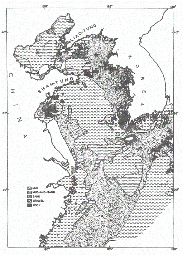
Figure 1. Yellow Sea Bottom sediment chart.
Course Instructor: Prof.
Peter Chu. Office: Spanagel 237. Telephone: ext. 3688