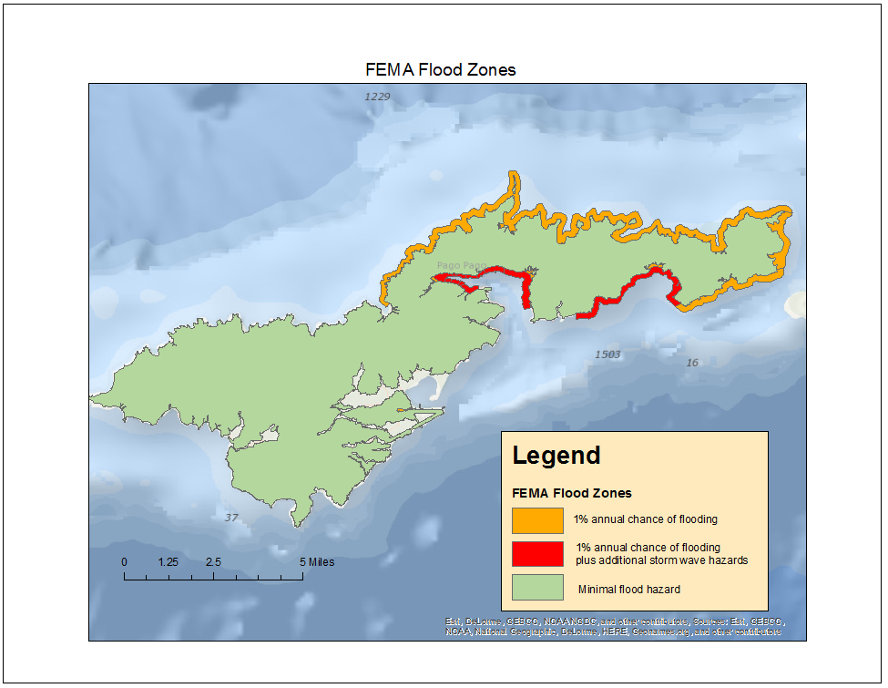
Description: Flood zones for the island of Tutuila from FEMA. Note: the other islands' floodzones are also available as separate files. Attributes:Area, perimeter, FIRM #, zone, either A, AE, VE, or X.
FIRM is the Flood Insurance Rate Map. According to documentation at https://snmapmod.snco.us/fmm/document/fema-flood-zone-definitions.pdf, A denotes areas with a 1% annual chance of flooding and a 26% chance of flooding over the life of a 30-year mortgage. AE is similar to A, but where base flood elevations are provided. VE denotes coastal areas with a 1% of higher chance of flooding and an additional hazard associated with storm waves. X denotes areas of minimal flood hazard, usually above the 500-year flood level.
Projection and Datum:GCS WGS84
Data format:polygon shapefile
Source or Contact info: Resides on the PacIOOS Geoserver at http://geo.pacioos.hawaii.edu/geoserver/web/.