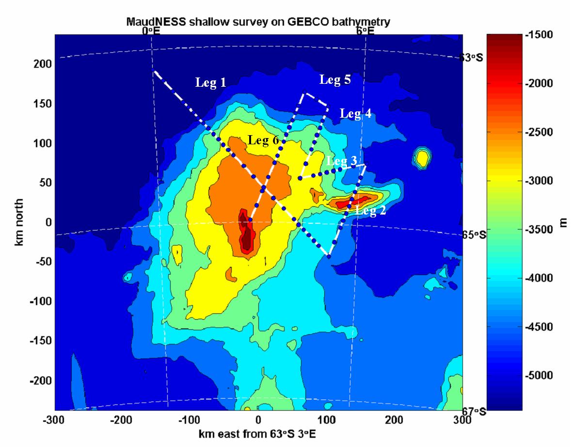
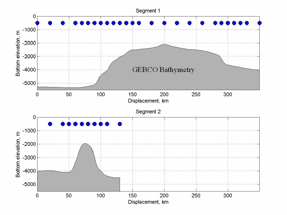
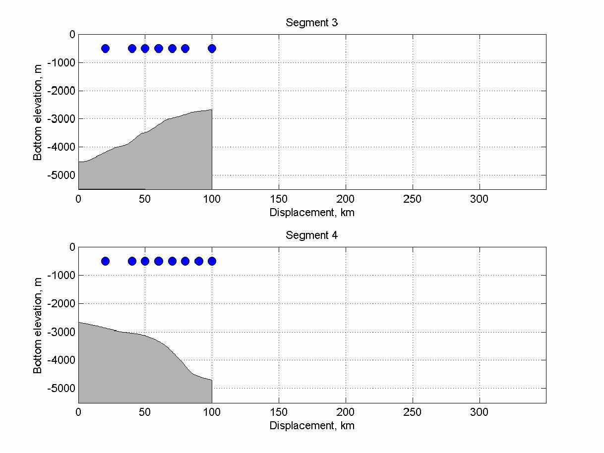
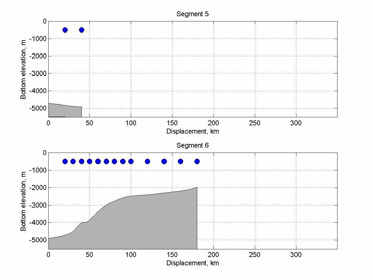
Phase 1: Rapid, shallow CTD survey of the Maud Rise region. Each profile (or class of profiles) will be modeled forward in time to search for likely convective/thermobaric instability by late August. During the survey, surface buoys and subsurface floats will be deployed. The former will communicate local conditions to the ship via Iridium link. Data from the floats will be collected via satellite in the following summer.
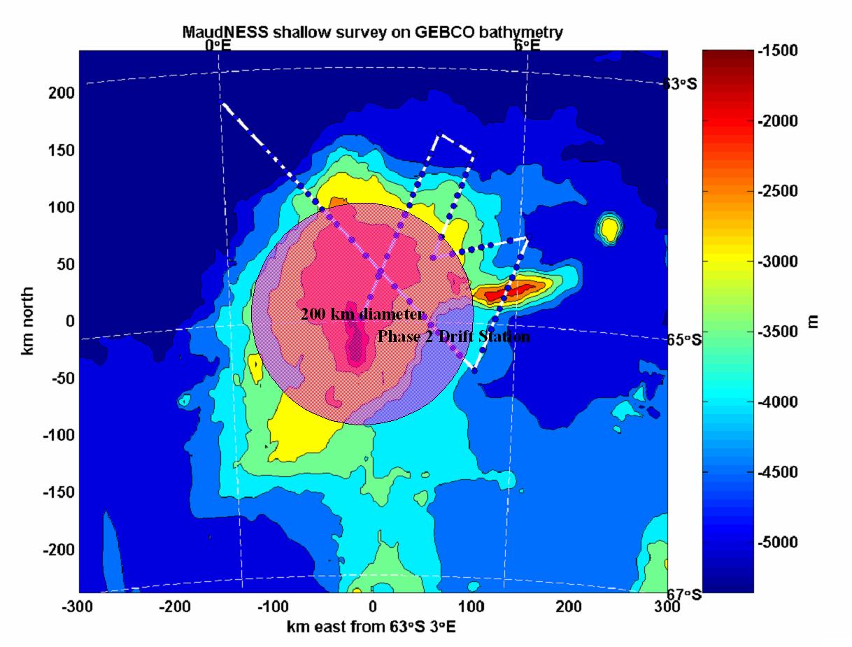
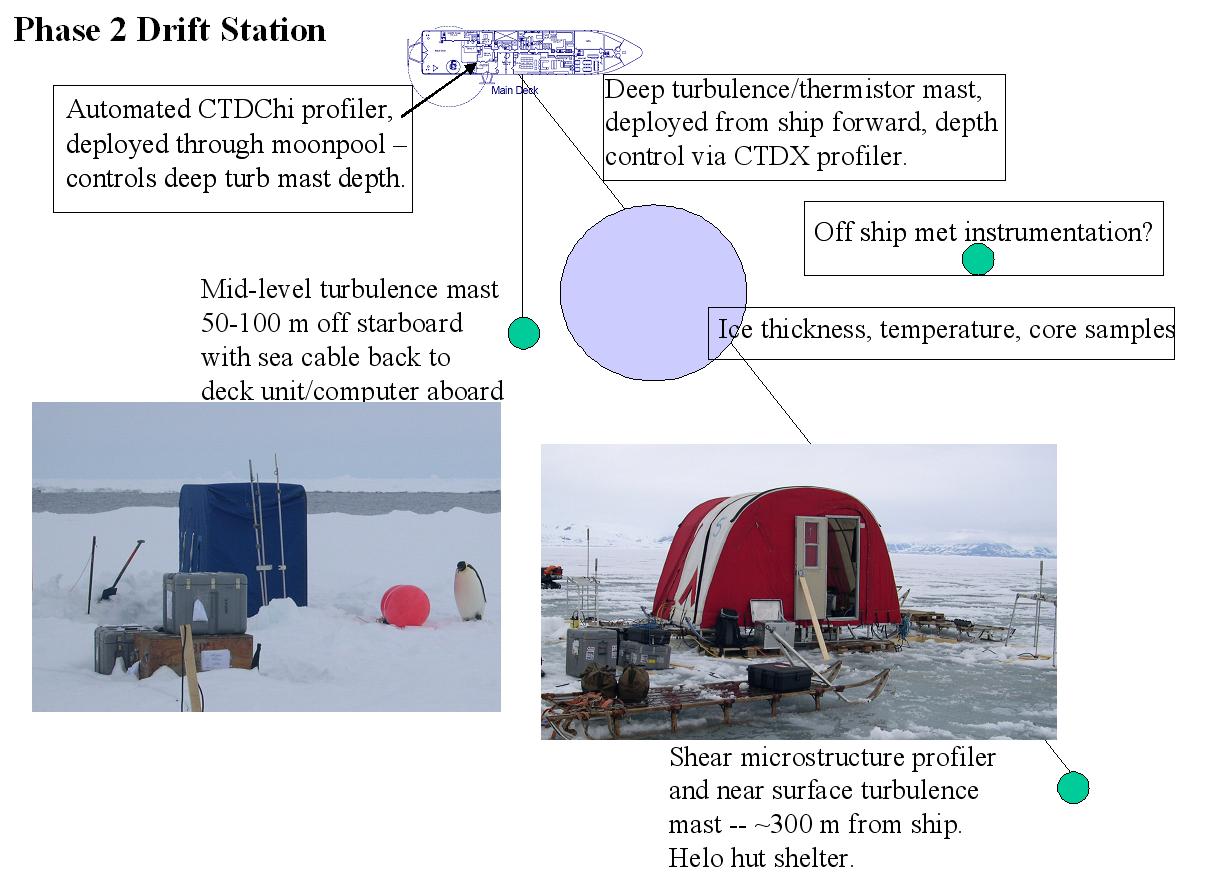
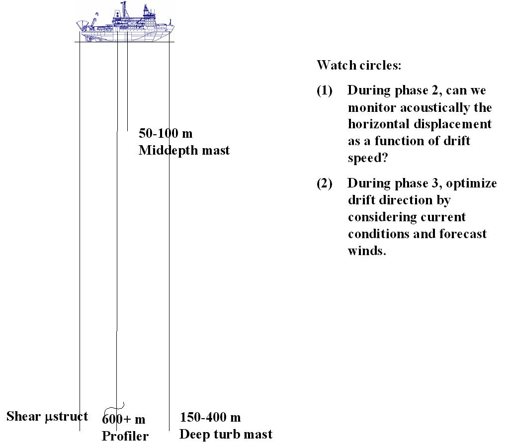
Phase 2: A passive drift station initially near the center of Maud Rise (typically more stable than the slopes). The main objective is to monitor fluxes in and near the lower part of the boundary layer in a relatively stable situation for later comparison with conditions where the density contrast between the mixed layer and underlying pycnocline is small.
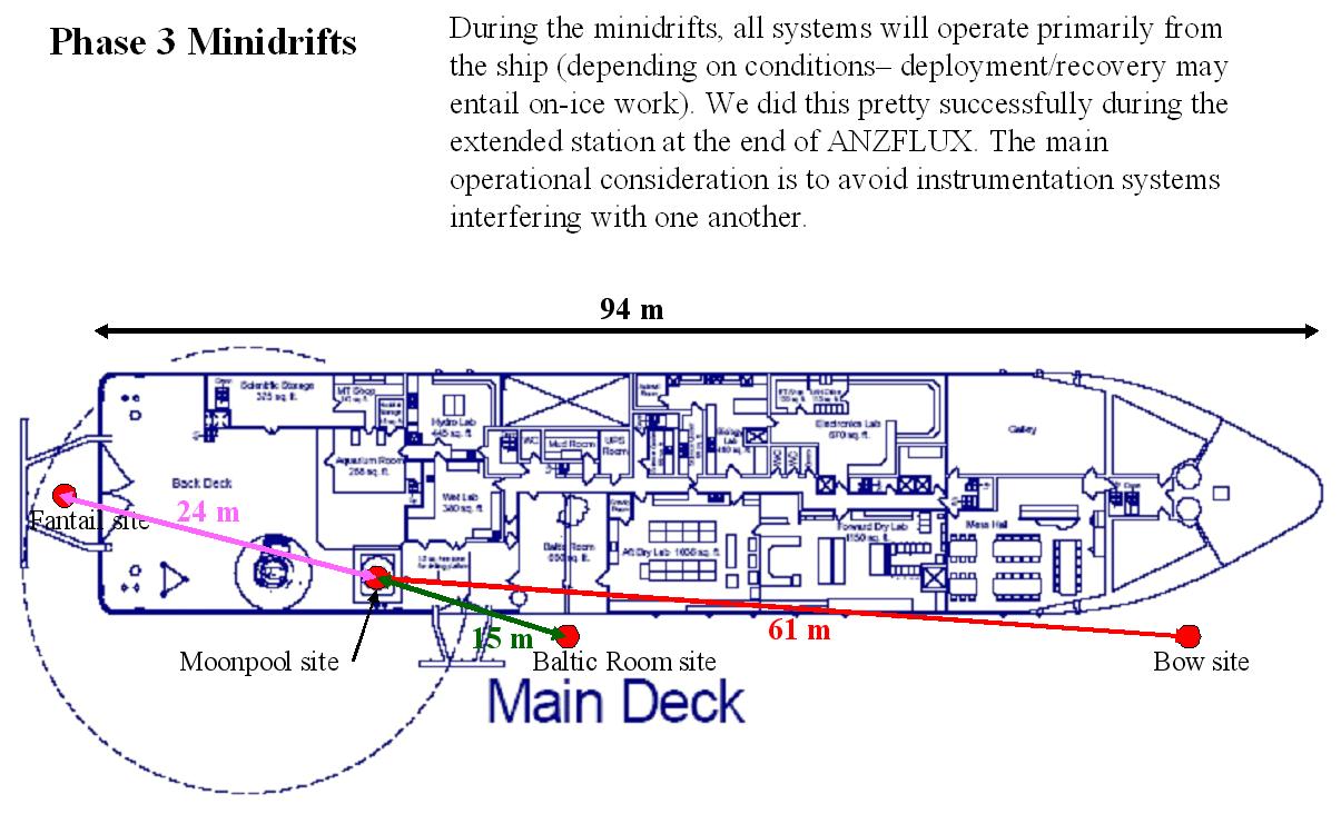
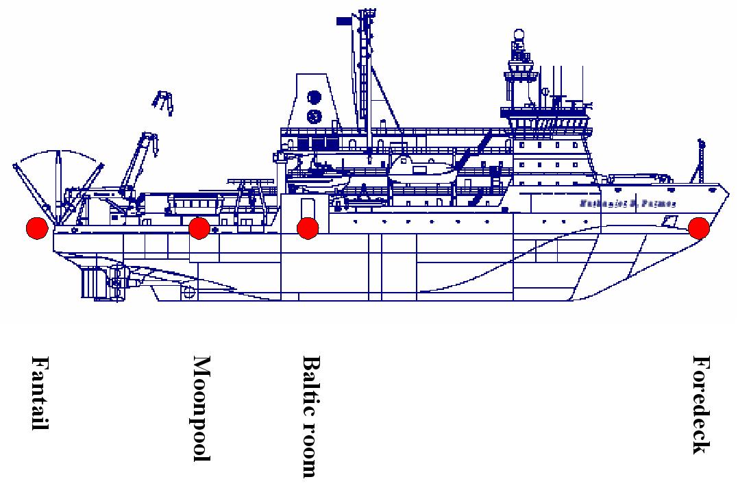
Phase 3: In this, the most complex part of the experiment, we will use a combination of our initial survey, remote sensing and modeling to pick the region most likely to be unstable, particularly to nonlinear equation of state factors. The ship will return there, and after an abbreviated CTD survey, we will seed a patch of pyncocline water with a subsurface float configured to stay at mid-depth in the pycnocline, and then execute a series of “minidrifts” where the ship and its upper ocean measurement systems drift passively for periods during which we can safely track the float acoustically. When the safe tracking limit is reached, we will return to the float and begin another short drift, thus measuring the evolution of turbulent exchange in upper pycnocline as instability is approached.
Phase 4: If a major polynya event becomes apparent during late austral winter (this does not happen every year), we will go the area and measure oceanographic conditions both at the periphery and across the polynya.
Enroute PA to start of Phase 1 @ 60o15’ S, 0o E: 10 days
(PA -> 55S22.5W -> 60S 0E – Open ocean @ 12 kt ; 60S 0E to 63 15S 0 E – ice @ 5 kt)
Phase 1 Survey: 7.5 days
486 nm @ 5 kt, 66 shallow stations at 1 h ea, 6 buoy/float deployments @ 4 h
Phase 2 Drift Station 10 days
Phase 3 and 4 Water Parcel following/open polynya 18 days
includes up to 4 days for initial positioning, short survey
Transit to ice edge, including deep stations: max 6 days depending on conditions
Ice edge to Punta Arenas: 8 days
Total: 60 days: 20 Jul to 18 Sep