After five years of preparation a team of scientists has successfully drilled through the profoundly remote Pine Island Glacier ice shelf in Antarctica. The objective is to study processes that are causing rapid melting of the 60km long ice shelf that extends out into Pine Island Bay, reflected in recently increased speed of the ice streams on the Antarctic Continent feeding the floating ice shelf. Results from this project will be used to improve the physics of numerical models predicting future melt rates of the massive West Antarctic Ice Sheet. Increased melting of these ice sheets has the potential for significant global sea level rise with wide-ranging consequences. Analysis of satellite imagery and altimetry has shown that this part of the massive West Antarctic Ice Sheet has the highest thinning rates in Antarctica. The tightly collaborating international project includes specialized research groups doing the hot water drilling, seismic and radar surveys of the ice shelf and sea bed structure, and development and deployment of purpose built ocean instrumentation that will be left in the ocean cavity below the ice shelf to measure circulation and ocean/ice interactions over the coming years.
Logistic support of this project has presented significant obstacles, as the measurement site is 1200 miles from McMurdo Station, the primary staging facility for National Science Foundation United States Antarctic Program. Early visits to the ice shelf by Twin Otter planes and analysis of satellite imagery by Bob Bindschadler, a retired NASA scientist, showed that the heavily crevassed ice shelf would require helicopter support for some of the sites selected to study, which in turn required a more elaborate support camp with a 10000’ runway to enable LC130 cargo planes to land. After a flight-constrained project last austral summer season, the support plan was modified to include early season Twin Otter plane support to move equipment and personnel directly to the drill site on the ice shelf while the support camp was being built up. As a result, during this season, the first of three drill camps was established on 1 December by the small, powerful Twin Otter airplanes, allowing equipment preparation to be completed and drilling to be started by 8 December, well ahead of schedule.
Profiling ocean waters:
One of the primary tasks for the team has been to use a hot water drill run by Martin Truffer at the University of Alaska, Fairbanks, to make two 500-meter deep, 20cm diameter skinny holes through the ice shelf at each measurement site. A simple hot water drill is being used consisting of five high output diesel water heaters feeding a 3/4” hydraulic hose connected to a long brass head which slowly melts through the solid ice shelf. The 500m of hose is figure 8 coiled by hand near the bore hole, making it a labor intensive operation. A well pump recirculates the melt water back to the water pump and heaters. Once the drill reaches the ocean waters below the shelf, a camera system developed by Alberto Behar, from JPL is lowered to check the bore hole for bumps, and to assess the ice roughness below the shelf, which influences ocean mixing rates, and to photograph the seabed.
Highly specialized long term instrument systems were developed to fit down the 20cm diameter bore holes in Tim Stanton’s research group at the Naval Postgraduate School (www.oc.nps.edu/~stanton/pig). A surface-powered instrument package lowered through the first bore hole to hang 2m below the ice measures the boundary layer currents and rate of mixing of ocean water right below the ice, allowing the local ice melt to be calculated. Thermal structure of the ice shelf itself is determined by a string of 16 precision electronic thermometers extending 100m up into the ice to estimate the strength of the ice shelf as it is heated by ocean warming events. Today the group has prepared a second bore hole 20m from the first to deploy an ocean profiler that will move up and down a vertical cable extending from the ice base to near the ocean bed, measuring ocean circulation and temperature / salinity structure within the cavity over the next couple of years. It is designed to identify all the processes that control the transport of heat through the ocean cavity to the inland ice shelf grounding line. Both sets of instruments connect up through the ˝ km thick ice to a solar and wind-powered communications and meteorology instrument tower on the surface of the ice shelf. Two-way satellite communications to Stanton’s laboratory in Monterey transfer the different data sets back each day, and allow sampling strategies to be remotely changed, including the sampling interval and parking depths for the profiler. Initially the profiler will sample several times a day, to observe tide-related changes in water properties and circulation within the ocean cavity, then will operate at longer profile intervals to conserve it’s limited battery power to resolve seasonal changes in circulation and heat transport.
Explosions and sledgehammers:
Sridhar Anandakrishnan and Leo Peters, geophysicists with Penn State University, are creating tiny earthquakes to study the shape of the ocean cavity and the properties of the bedrock under the PIG ice shelf. Leo and Penn State student Kiya Wilson have been doing seismic measurements around the first and second drill camp sites, then, with helicopter support, they will occupy about 40 locations across the ice shelf to determine the larger scale sea-bed shape and ice shelf structure.
Peter’s technique, formally called reflection seismology, involves generating waves of energy by setting up small explosions or by using sledgehammers hitting steel plates to bang the ice. He records how long it takes for the waves to travel through ice and water, bounce off the seabed and return, and analyzes the strength of the echo. Both factors will tell him about the thickness of the ice and water. A low frequency radar system dragged on the surface behind a snow machine accurately measures the ice shelf thickness, resolving the hills and valleys underneath the ice shelf first seen in a collaborating British Antarctic Survey remote mapping of the area. An important initial objective for the geophysicists is to better map a ridge that runs across the ocean cavity under the ice sheet. This ridge was unknown to researchers when they designed their project in the early 2000s; it wasn’t until 2009 that a robotic submarine diving under the ice detected it. Its existence has made the project scientists rethink where they will place their oceanographic instruments under the ice shelf, so that deep sensors do not hit the ridge as the ice shelf continues its 4km / year advance toward the sea. Measurements of melt rates around the ice shelf are also being made with a coherent radar unit by Mike Shortt, who is working with collaborating British Antarctic Survey scientists.
This challenging project, funded by the Office of Polar Programs at the National Science Foundation, has received outstanding support from the many people at McMurdo Station, the PIG support camp, and the logistics group at the drill camp. They have helped overcome the challenges presented by this of this remote location and enabled a successful science program on the ice shelf. The next challenge for the drill camp personnel is break down the camp and move it to the next of three sites, 8km up the ice shelf to a more crevassed area to study conditions in the inner ocean cavity separated by the cross-shelf ridge.
|
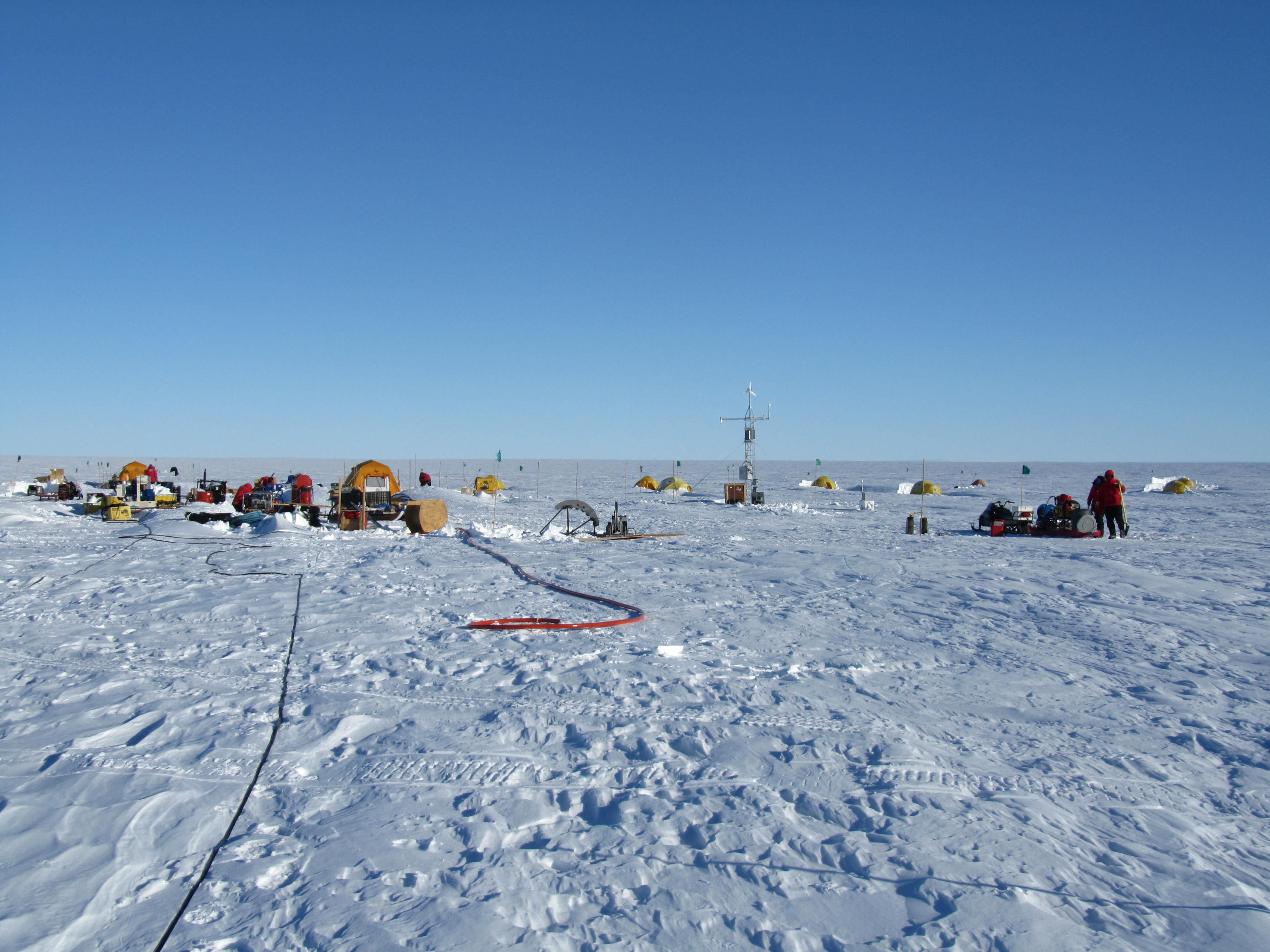 The drill camp at the Pine Island Ice Shelf. The galley is on the left, hot water drill equipment in the center left, surface infrastructure tower mid right, and the seismic sled on the right.
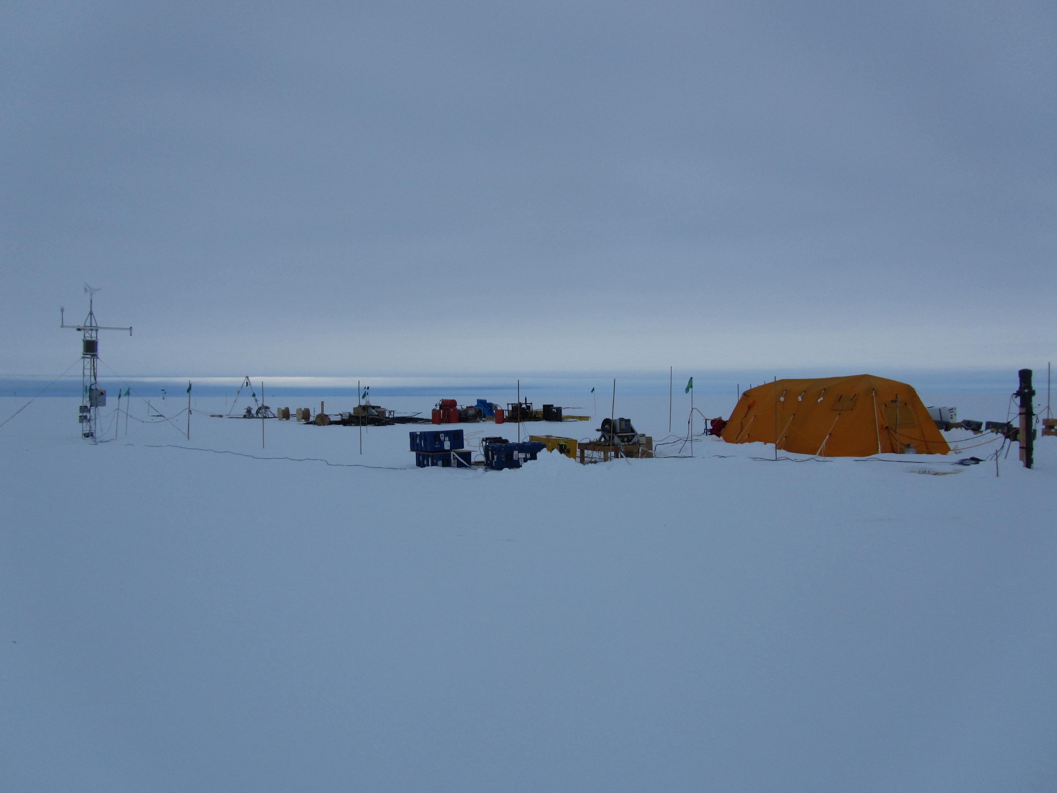 The surface infrastructure tower (left), drill equipment (far distance), winches (near center) and science tent (left) at the first PIG drill site.
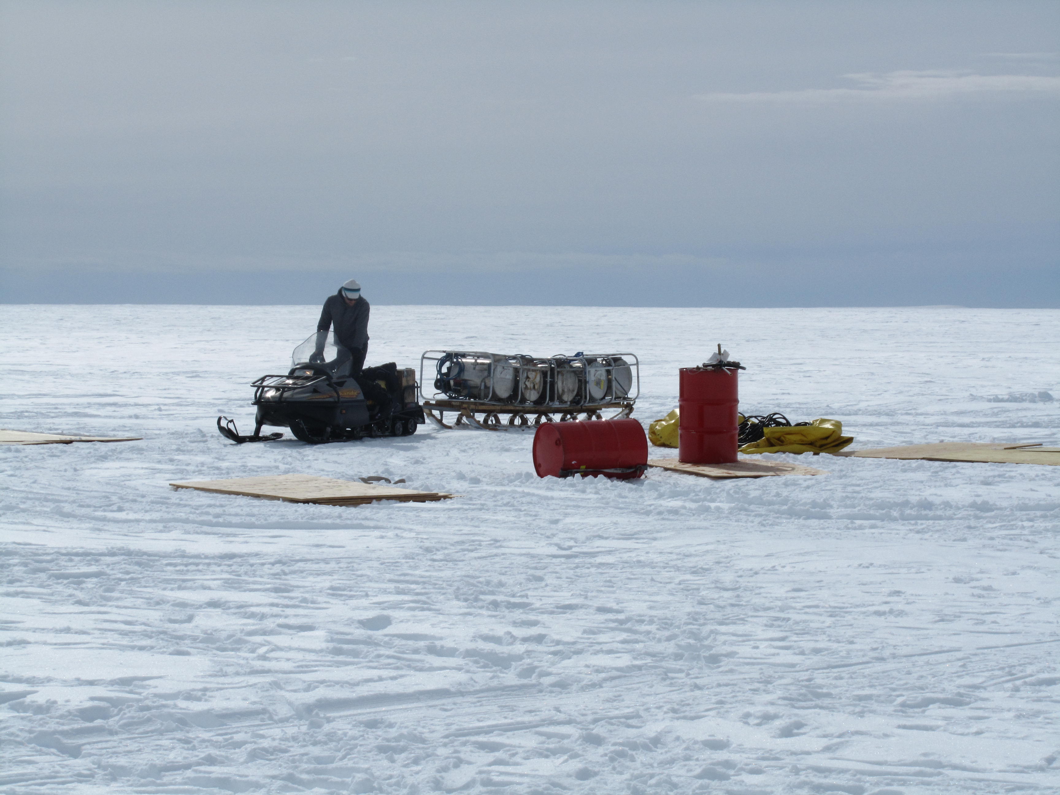 A sled with the hot water drill heaters is moved into place by Einar Steinersson, a mountaineer who oversees safety at the camp
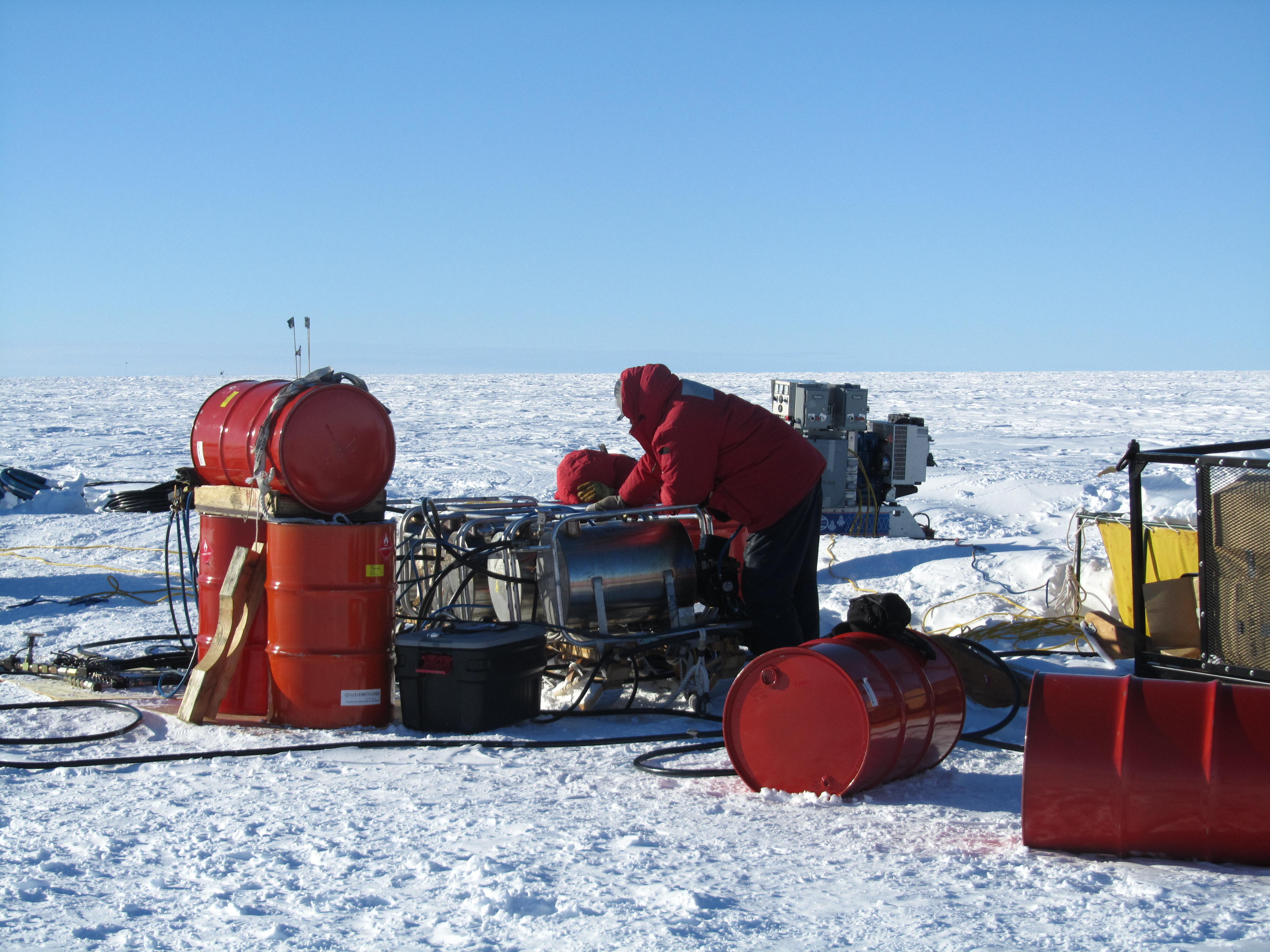 The five hot water heaters are being set up by Martin Truffer and Dale Pomraning from the University of Alaska, Fairbanks.
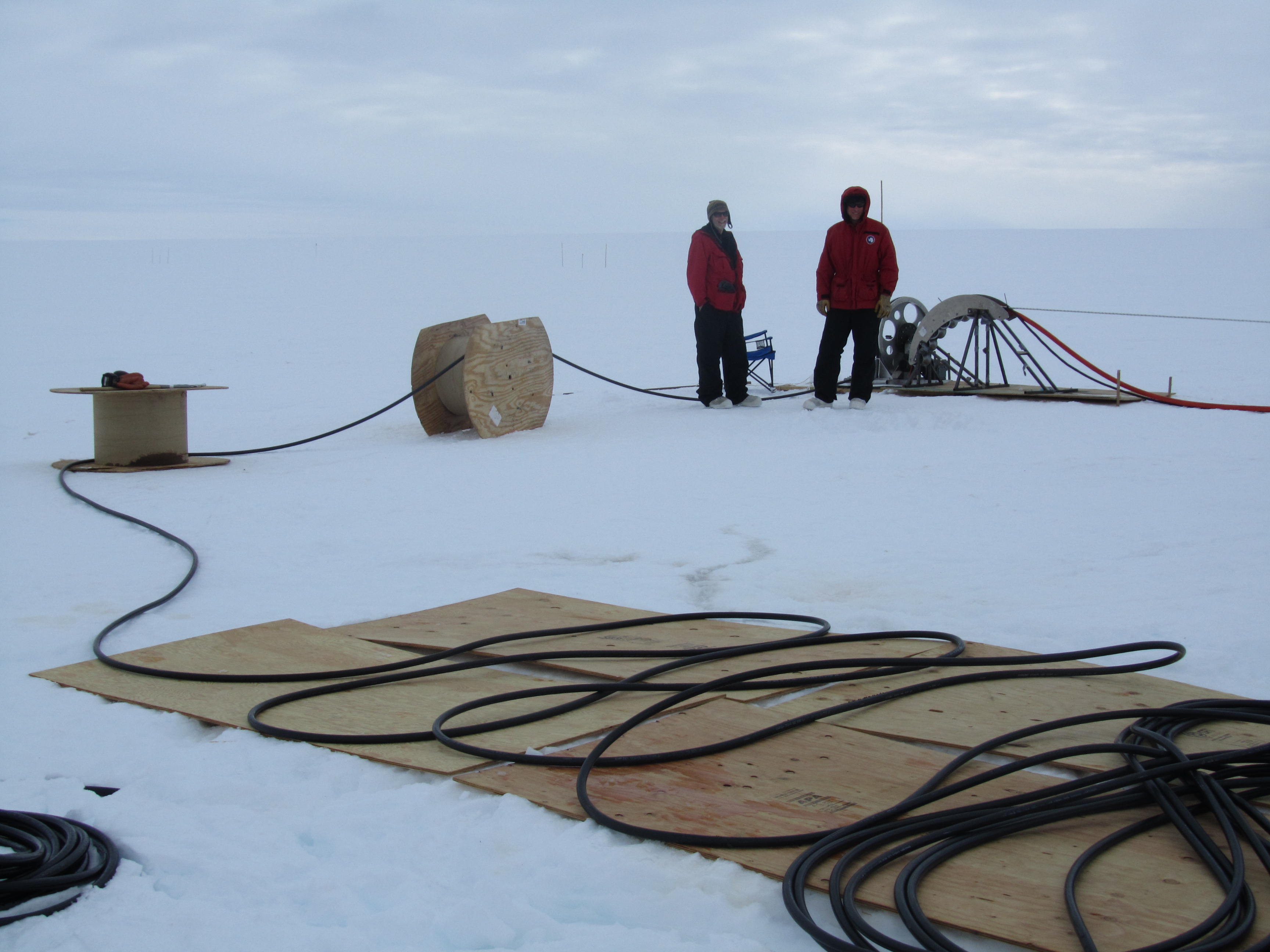 500m of figure-8 stacked hose feed into the bore hole around a speed-controlled metering wheel to ensure that a uniform hole is formed. The hose and water nozzle descend at about 2cm / second.
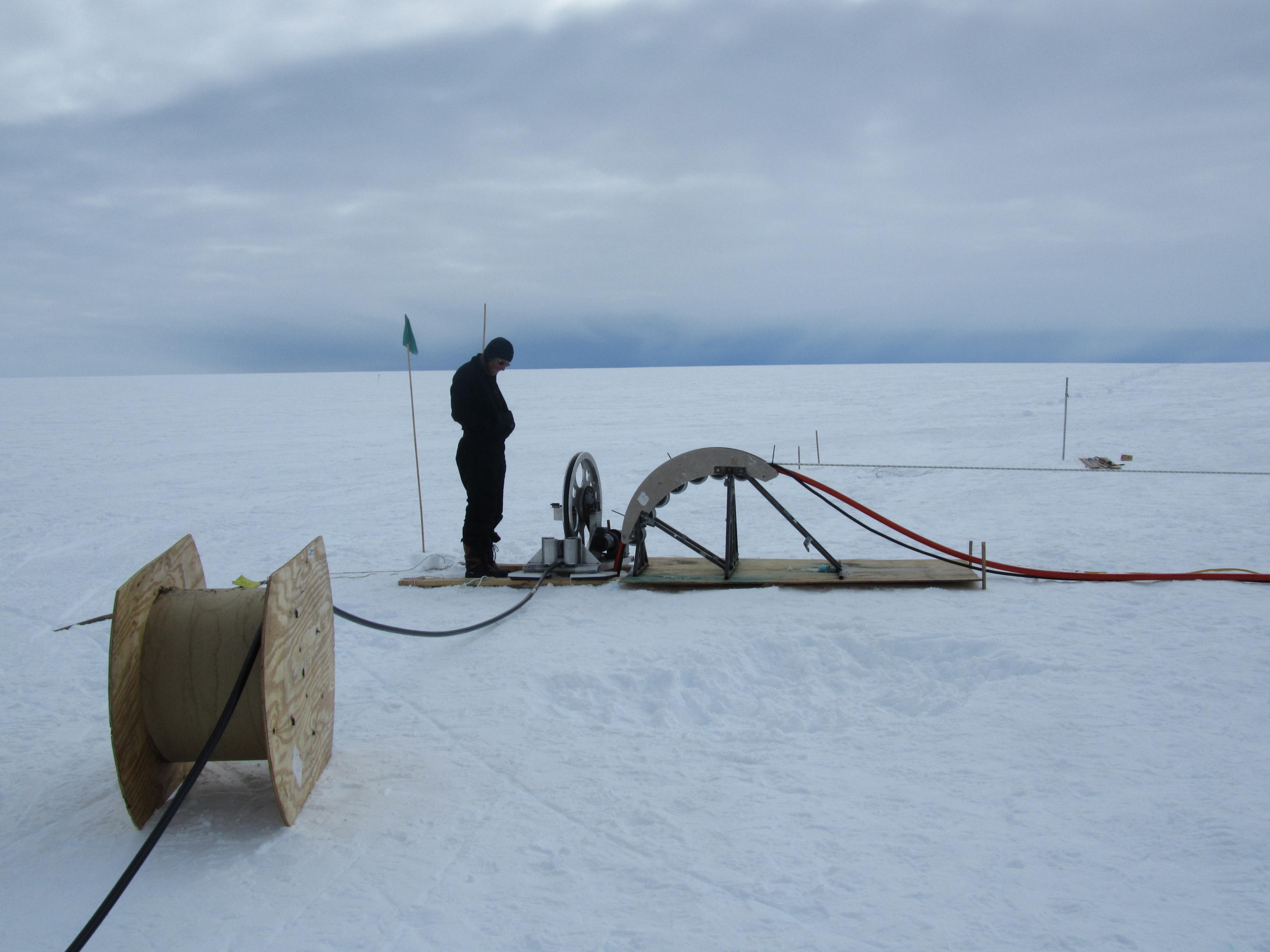 Martin Truffer oversees the metering wheel that controls the descent rate of the water spray drill head.
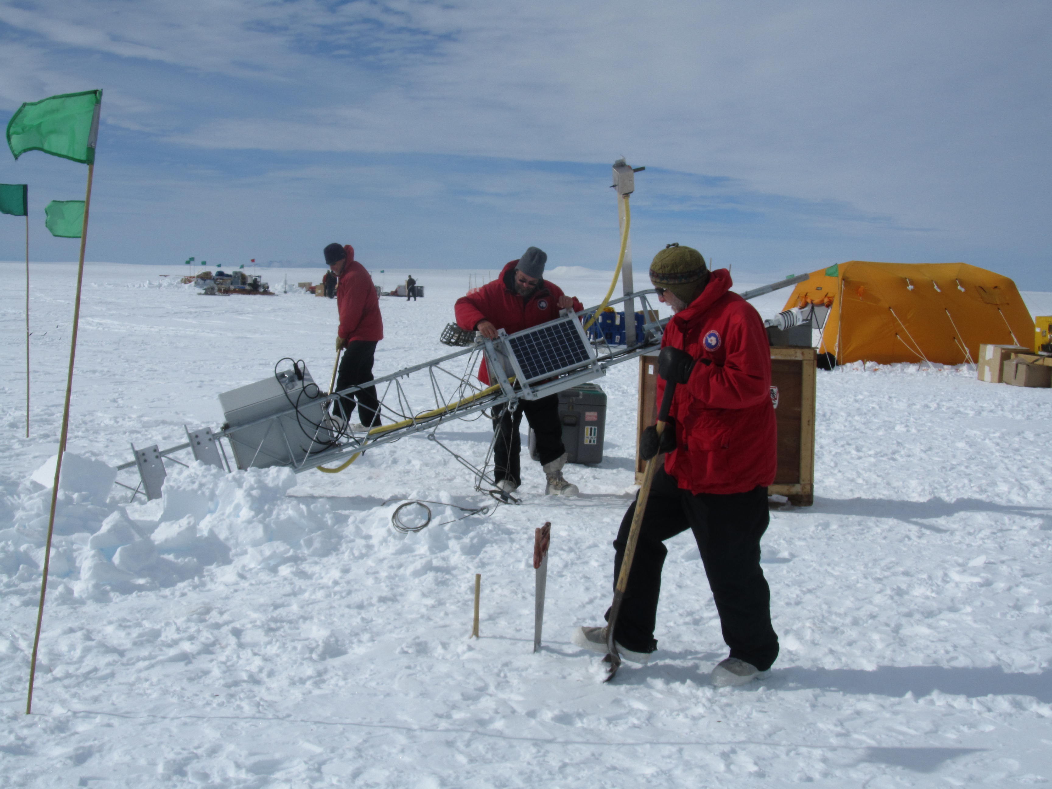 The infrastructure tower which ties together the ocean and surface sensors left at PIG is assembled by the NPS group. The tower facilitates two way communication between the sensors and computers at NPS to transfer data home and change instrument setups remotely over the next couple of years.
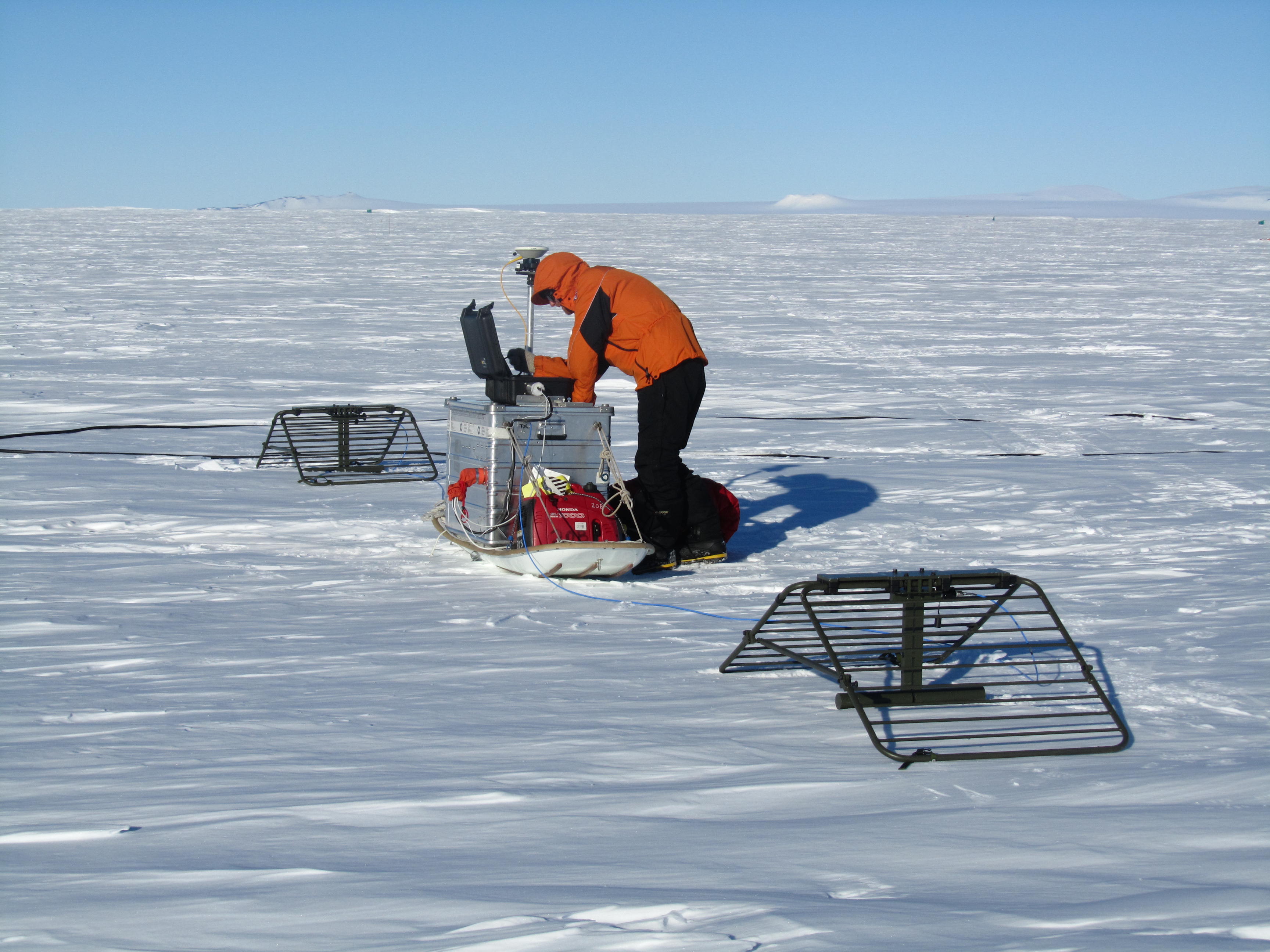
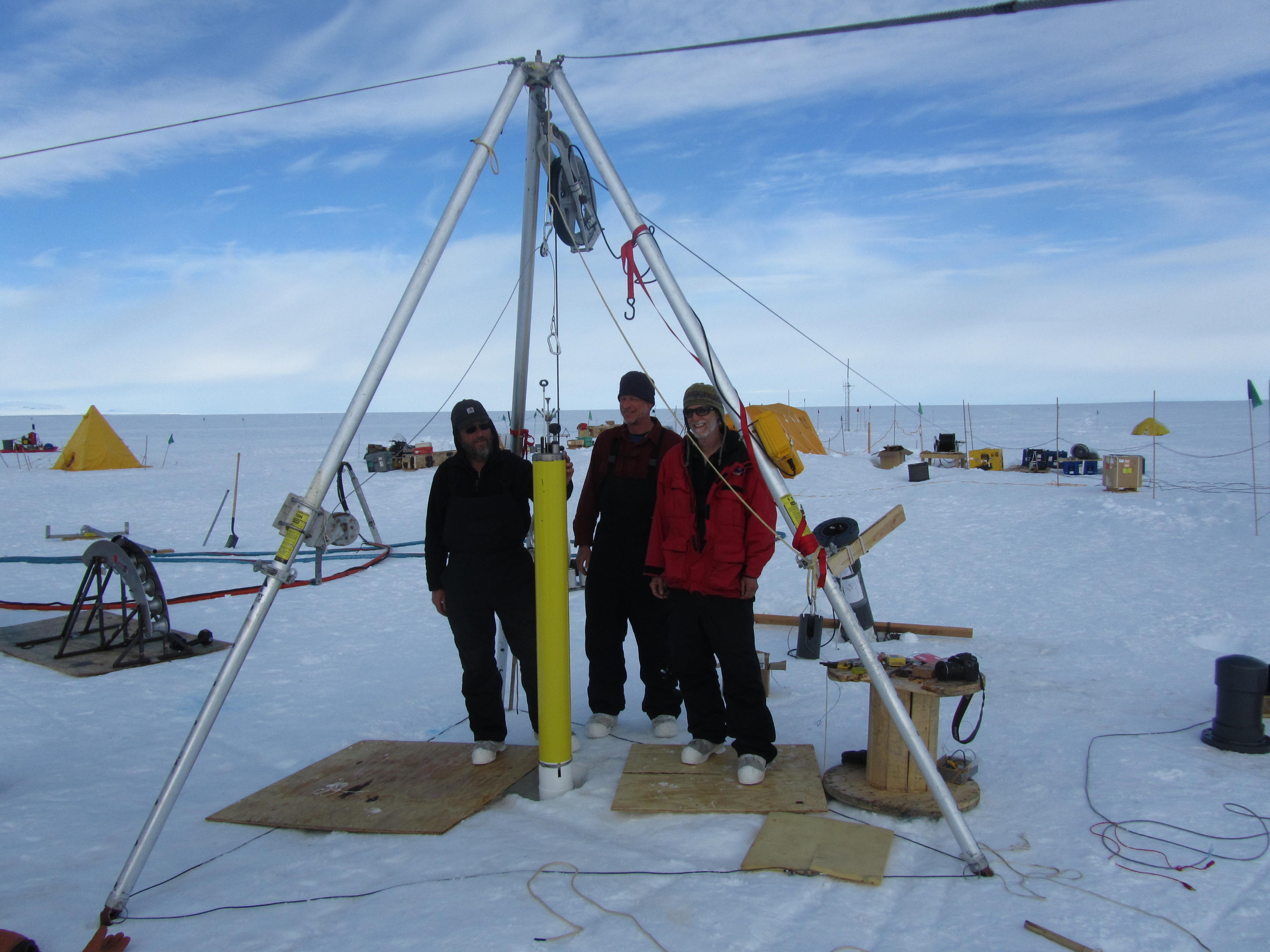 NPS research team members Stanton, Shaw and Stockel deploy the ocean flux profiler developed in their research group at NPS down a 460m deep bore hole through the Pine Island Glacier Ice Shelf. The profiler will measure temperature, salinity and current profiles through the water cavity below the ice shelf every day over the next two years to study processes controlling ocean melting of the ice shelf.
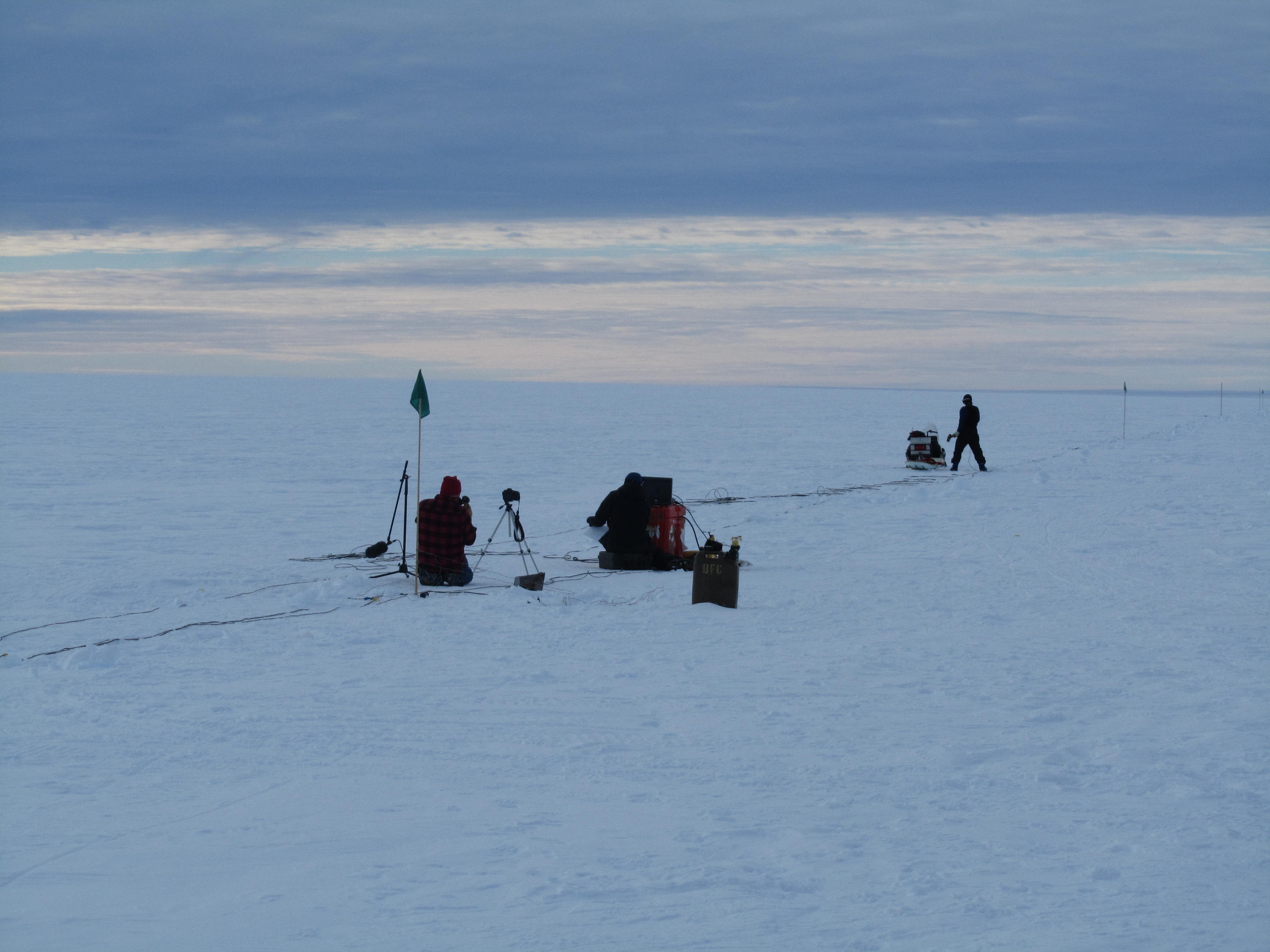 Leo Peters and PhD student Kiya Wilson from Penn State use a sledge hammer striking a steel plate to generate sound pulses being heard by a line of geophones to probe the ice shelf and sea-bed structure. Sal, the drill camp manager, cook, and cinematographer is filming them at work.
 Mike Shortt working with scientists at the British Antarctic Survey is making a series of radar-based ice thickness measurements that resolve melting rates of the ice of periods of days to months.
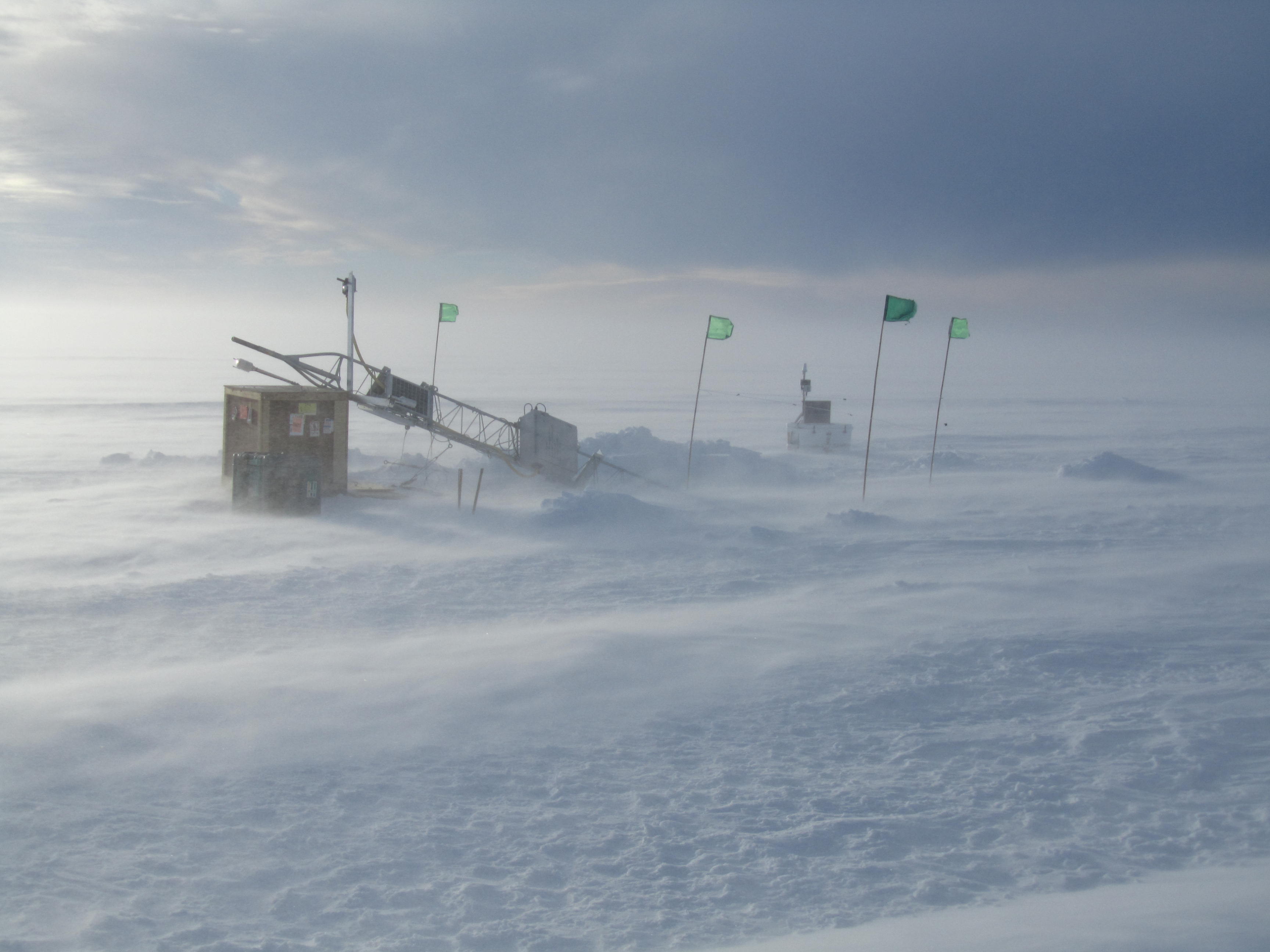 Strong winds close down the outdoor work at the PIG drill camp.
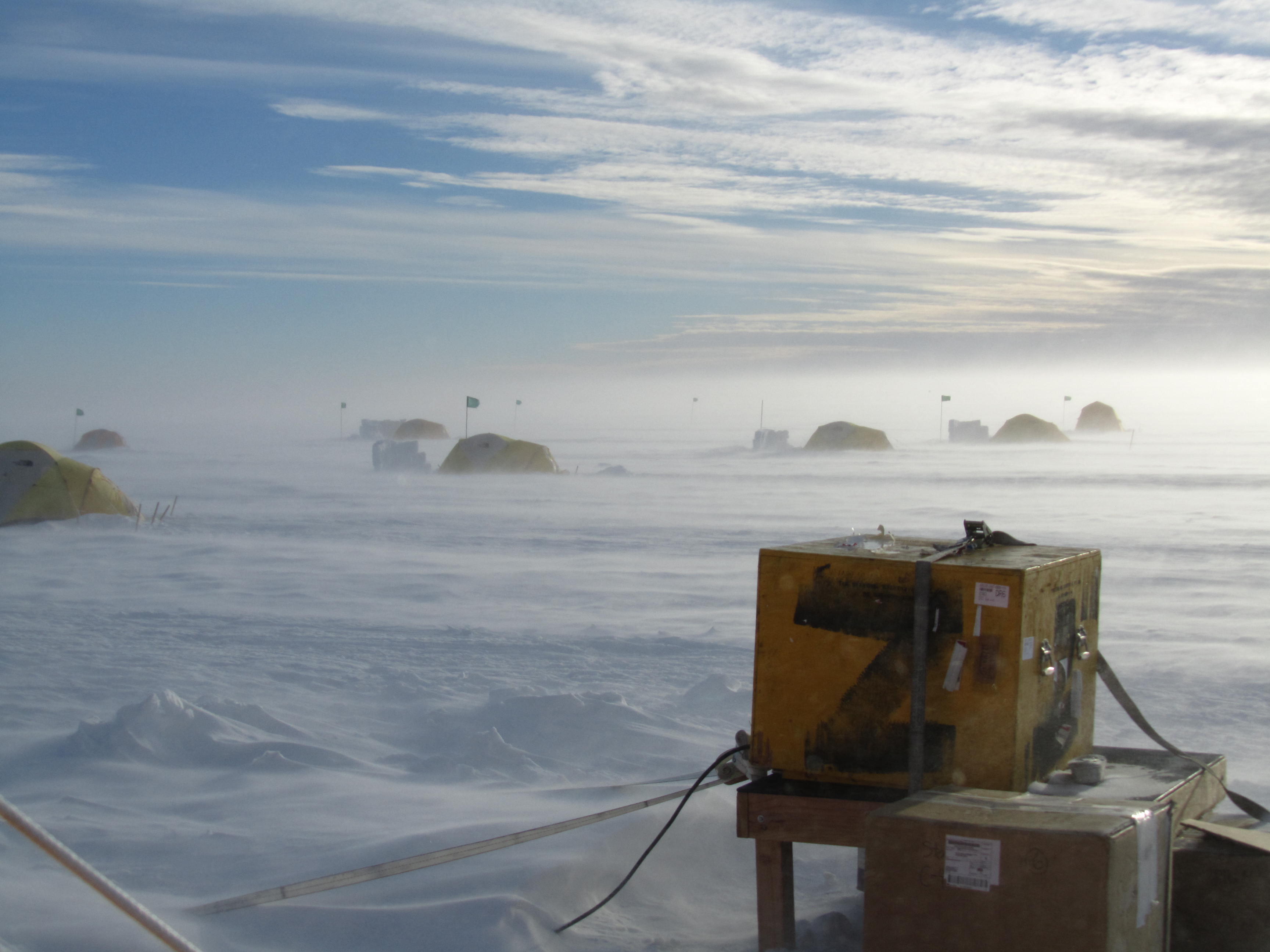 While the weather has been good at PIG this season, there are days when the 20-30 knot winds shut most work down. The blowing snow rapidly forms deep snow drifts that have to be dug out when work begins again.
|
|
|
|
3 Dec 2012
|
Bad weather prevented flying out of WAIS Divide for 5 days, but we enjoyed the company and great food there through Thanksgiving week. On Friday I had the opportunity to be co-pilot for the rented British Antarctic Survey Twin Otter airplane flight taking 2000 lbs of freight down to Pine Island Glacier (PIG), 280 miles away. They are single pilot planes, so are willing to take anyone to help out-flying some and helping with loading and unloading freight. We had clear sunny weather most of the way, and it was great standing on the PIG ice shelf again a year later on a spectacular day. After ˝ hour unloading freight at the future drill site, we flew low over the spectacular shear zones on the sizes of the rapidly moving ice shelf up to the PIG support camp. I spent the afternoon helping dig out equipment stored through last winter in an ice berm. It has been tough and slow going for the ice camp personnel and 4 people in our science group who had been there for the last 12 days, with limited heavy equipment to move the 12 foot deep snow and ice drifts while also preparing a 10000’ runway to allow larger LC130 aricraft to land soon. While I was at the support camp, the Twin Otter took a geophysical survey group (and freight) from Penn State down to the ice shelf site to determine the shape of the base of the ice shelf using a low frequency radar. At the end of a long day I piloted half of the return flight back to WAIS.
After days of freight juggling at WAIS, on Decenber 1st four of us flew down to the PIG Drill Camp that was established the day before. We had yet another brilliant clear day, put up our mountain tents and enjoyed a great dinner, camping style, cooked by Sal, an experienced camp manager and photographer. The warm (-10C to – 15C), sunny, low wind weather has continued allowing us to put up our 12’ by 20’ science tent where we will set up and test our ocean instrumentation in advance of the actual hot water drilling through the ice shelf. We are still waiting for the heavy generator and water pump that have to come down from the support camp, along with the University of Alaska, Fairbanks drill team who we will be helping. We hope the good weather holds as we get down to business at this profoundly remote field site.
|
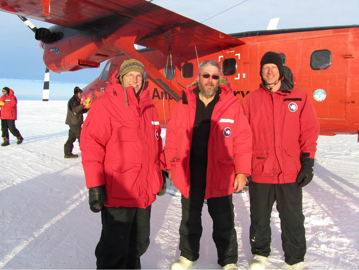 |
Jim Stockel, Tim Stanton and Bill Shaw from NPS depart from WAIS Divid
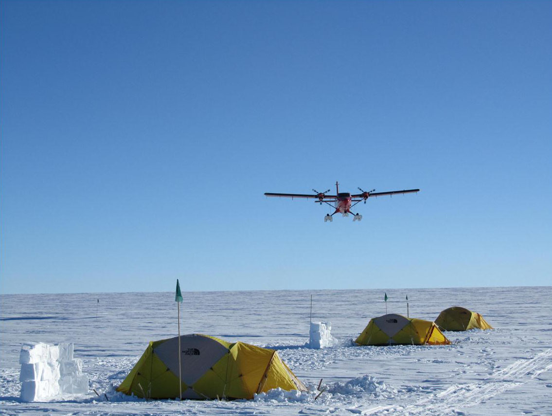 |
The Twin Otter approaches low over the drill camp, bringing equipment from the support camp 50 miles up from the ice shelf.
|
|
26 Nov. 2012
|
Our progress in getting to the Pine Island Glacier (PIG) drill site has been much better than last season. We flew into McMurdo Station on 17 November, and were able to get through all the check-ins and field training in a couple of days. While we have all been through it before, it is a good time make sure everybody knows how to put up our mountain tents, deal with the cold, stay safe, and minimize our impact on this pristine environment. Best of all we left McMurdo on time on 22 November on a LC130 (Herc) bound for the Western Antarctic Ice Sheet (WAIS) deep field camp which supports three science programs including PIG. It is a nicely setup camp with a heated RAC tent with running water and TWO SHOWERS in the end unit. The shower charge is shoveling two barrels of snow into the water melter. It is very comfortable, and the food is great.
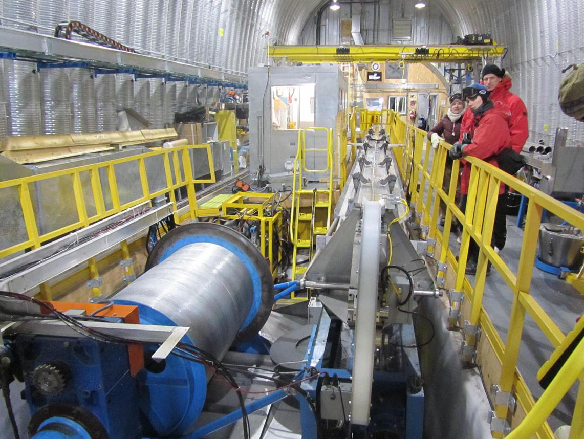
This afternoon we had a tour of the deep drilling project located on the edge of the camp, run by a glaciology group from Penn State. Over the course of several summer seasons, they drill a DVD-diameter ice core down to 3600m depth below the 2000m high surface. Particles and gas bubbles trapped in the ice provide a climate record stretching back 65000 years, complimenting similar core records drilled through the Greenland ice-sheet. Since snow builds up the ice shelf by about 1m each year, the drilling station is now under the ice sheet surface about 8m since it’s 2004 deployment. The whole facility is contained in a large arched under-ice room.
Tomorrow we are scheduled to leave this fine camp for a more primitive frontier camp at PIG, where we will be moving our equipment stored on a snow berm last season down to the PIG ice shelf drill site. In the next two months we plan to drill up to 6 holes 500m through the ice sheet and deploy instruments developed in our Ocean Turbulence Laboratory down into the ocean cavity below the shelf. These instruments will measure ocean circulation and turbulent fluxes between the water and ice over the next year, reporting by satellite every day back to NPS .
|
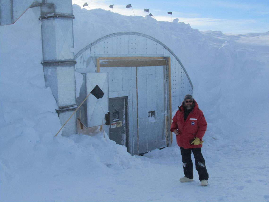 |
The sunken entrance to the drill and core handling facility.
 |
The under-ice “Arch Room” that houses the Penn State deep ice sheet drill studying the last 65000 years of climate conditions.
|
|
|
|
| | | | | | | |